 David Macdonald &
  Sarah Collins, British Geological Survey
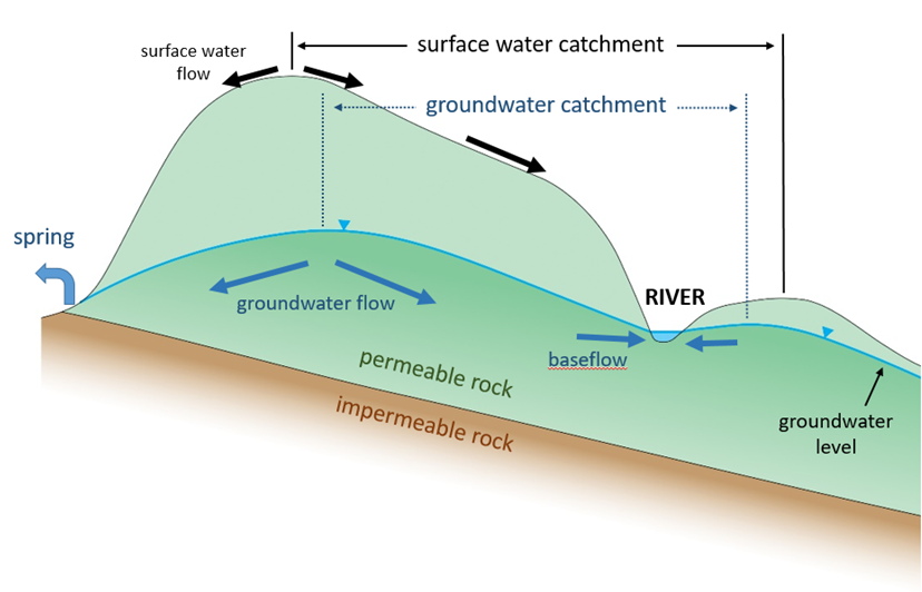
When we study water flows in the environment we often focus on the catchments of rivers. The catchment is defined as the area that drains towards any specific point in a river. The edge of a catchment in its upper reaches coincides with the highest ground, where runoff from rainfall will flow in differing directions according to what side of the line of highest ground it falls on. Knowing the contours of the ground surface allows you to delineate the surface water catchments of rivers. However, this is only part of the story in areas where rivers are underlain by permeable rocks.
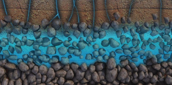
In these permeable catchments, groundwater, not surface water, is often the larger source of water to a river. Water that infiltrates into the ground, and deeper down to the saturated zone of the rocks beneath, will flow towards points where it discharges at the ground surface. This surface discharge may be into a river through its bed – this is known as baseflow (for more on this see the video below on ‘how rivers work’). But discharge may also be as a spring; into the sea, in coastal areas; or into wetlands, where the water is transpired by plants or evaporates from the surface.
Whereas a surface water catchment is defined only by surface topography and does not change with time, groundwater catchments are defined by the elevation and flow rates of groundwater discharge points as well as the rate of infiltration down to the water table. Therefore the extent of groundwater catchments to rivers are usually different to that of the surface water catchment (see diagram). As groundwater discharge and infiltration rates can change significantly seasonally, so can the extent of the groundwater catchment.
There are other reasons why the surface water catchments of rivers can be different to the groundwater catchments. The flow of groundwater is influenced by the permeability and structure of the rocks it moves through. Impermeable rocks, such as clays, that inhibit flow, and fractures and faults that create highly permeable zones that enhance flow, can cause water to move in directions that are different to that of the ground surface above. This can cause rainwater that flows through the ground to reach rivers that are well outside of the surface water catchments where the rain falls.
This all makes the assessment of rivers in groundwater-dominated catchments very complicated. The introduction of natural flood management measures is an added complication as they change the proportions of rainwater that run off over the land surface and that infiltrate into the ground. This is one of the key challenges being met within the Landwise project.
The UK Groundwater Forum have created a video on ‘how rivers work’ to assist in explaining the important role that groundwater plays in the environment.