I am a post-doctoral research assistant working on 3 core areas as part of work package 1 (WP1) ‘Local Knowledge and Scenarios’:
- Scientific research – using local knowledge to our further technical understanding of flood risk and land management practice to help inform policy and improve planning.
- GIS and mapping – identifying areas of flood risk and NFM opportunity to calibrate models.
- Science communication and engagement – understanding where communities are at risk and where NFM can make a difference.
I am a landscape ecologist turned hydrologist with a strong interest for SciComm, which is to understand and promote effective communication of science to diverse audiences through talks, maps, games, art and even a bit of poetry. As a researcher, I have a particular interest in understanding the effects of landscape change on biodiversity and ecosystem services in the UK, and more recently I’ve worked on seasonal flood forecasting in the Thames basin. The LANDWISE project is thus an excellent opportunity to bridge these two areas of science.
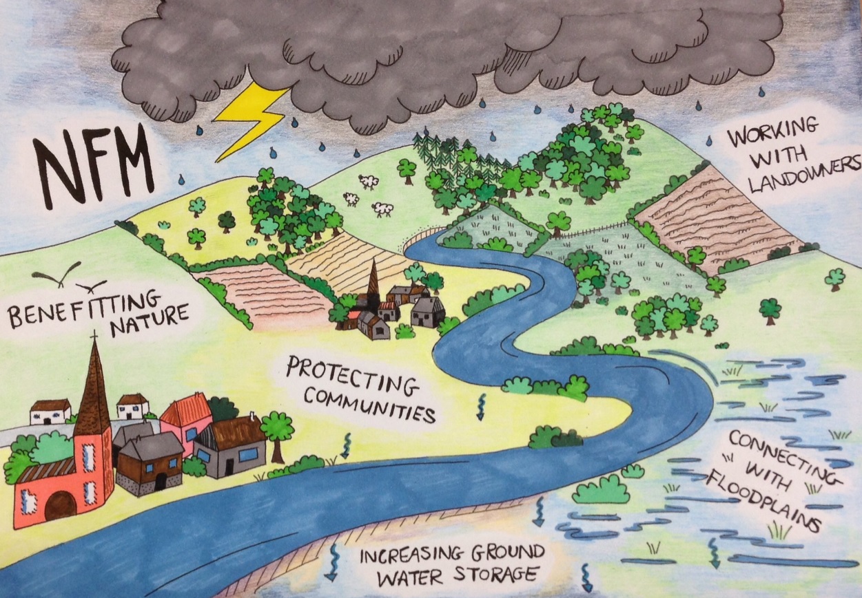
The ecosystems approach to managing our environment has been a hot topic over recent years and is recognised in policy and practice e.g. ‘Making Space for Nature’ by John Lawton, the Wildlife Trusts ‘Living Landscapes’, the Catchment Based Approach (CaBA) Partnerships and most recently the Natural Capital Committee’s advice on the UK Government’s 25 year environment plan.
I believe that land-based natural flood management (NFM) measures and the co-benefits they provide are a prime example of what can be achieved when we involve local people and work with our local environment. It is this that underpins the nature of my role in the LANDWISE project.
My responsibilities include understanding (and mapping) where communities are at risk of flooding in the West Thames, capturing farmer knowledge about land practice and soil management, and working with local stakeholders to co-develop future land-use scenarios for NFM. This will be achieved using a range of approaches including local community workshops, participatory mapping exercises, farmer surveys and focus groups. The evidence gained will be supplemented by field-based and remote sensing data collected as part of LANDWISE, and supported by technical information from scientific research, existing spatial data sets and expert opinion.
Dr. Jess Neumann
@jess_n1
https://www.reading.ac.uk/geographyandenvironmentalscience/About/Staff/j-l-neumann.aspx