 Dr. Will Maslanka joined the Landwise team in May 2019 as a postdoctoral research assistant to work on Remote Sensing (Work Package 3). Will attended the University of Reading, where he received a PhD in Atmospheres, Oceans, and Climate, on the topic “Extinction of Microwave Radiation in Snow”, where he undertook a ground-based remote sensing campaign in the Finnish Arctic. He has previously worked as a flood modeller and forecaster with the Environment Agency. He brings his catchment knowledge, and his fieldwork experience to the project.
His work is twofold; firstly, evaluating the relationship between broadscale land use and soil moisture, using data derived from the Sentinel 1 satellite constellation, in order to assess moisture regimes during wet and dry periods (such as the 2018 drought) for different land uses and soils. While point measurements of soil moisture exist, remote sensing observations are the only realistic way to get information regarding soil moisture on the catchment and basin wide scale. The Sentinel 1 satellite constellation uses radar data 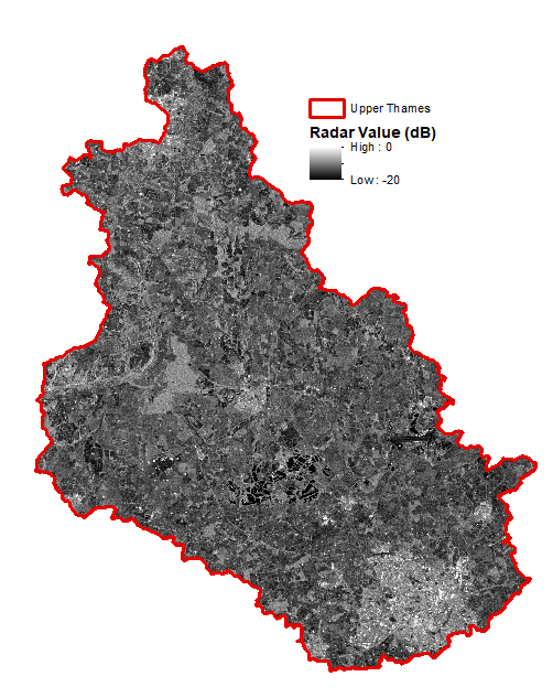 (UThames_180715.png) to get catchment-wide data.
The second avenue of work involves fieldwork, using a bespoke drone with a radar sensor to assess the field scale land use and practices and soil moisture regime.
Will is looking forward to getting stuck in with the fieldwork and to flying the drone (a novel approach to soil moisture data collection), although he is glad that he will not be working in sub-zero temperatures!