Be careful what you wish for. Britain’s seesaw rainfall patterns that began last winter have continued, with an on-off pattern of dry and then wet months for many areas.

In the south of England, last year’s drought was still affecting parts of the UK in early December, with stores of water in reservoirs and groundwater lower than usual. Seemingly endless rain followed over Christmas and January, before one of the driest Februaries on record led to renewed warnings of drought.
Hydrologists like me were pointing to low stocks of water in aquifers and rivers, raising our eyebrows and sucking our teeth like car mechanics faced with a blown gasket. We need rain, we said, or reservoirs will dry up, crops will fail, and restrictions on how much water people can use, like hosepipe bans, may be necessary.
Well, we got it. England and Wales had their wettest March in 40 years and April continued the wet trend, although rainfall was more patchy. The reason was that the jet stream, the fast-flowing and meandering air current high up in the atmosphere which governs a lot of weather in Britain and north-west Europe, shifted south. This pulled cold air down from the Arctic in early March.
Much of Britain shivered under this blanket of cold, with snow and ice blocking roads and closing schools. Then westerly winds returned, pulling cyclonic weather systems off the ocean in a stream of wet weather.
In April, the jet stream shifted north, leading to unsettled weather and lots of the April showers that we tend to expect of a British spring.
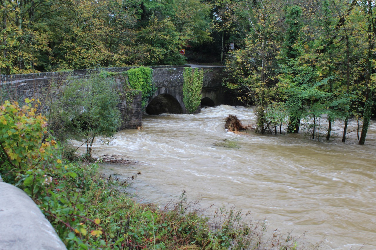
The result is that the hydrology of England and Wales – the state of the water supply in rocks, soils, rivers and reservoirs – has bounced back. In some areas, it has bounced back so quickly that there have been floods. The heavy thunderstorms of recent days in parts of south-west England caused flash flooding of the kind that scientists expect to see more of as a result of the warmer atmosphere created by climate change.
Parts of southern England now have higher levels of water in rivers and aquifers than we would expect at this time of year. Kent had almost twice the expected rainfall for April. Of course, this raises the risk of flooding – and almost any part of the country can flood, especially from such sudden, intense downpours falling onto concreted urban areas or saturated ground.
Scotland offers an interesting counterpoint. With only average rainfall over the past couple of months, parts of the country remain dry, with low river flows in the north heading into summer. Other regions look more normal for this time of year.
The European drought continues
The drought has been broken in much of the UK. But other parts of western Europe, which the British Isles had been sharing dry conditions with, remain parched. Spain and Portugal are seriously water-stressed, as is southern France and northern Africa.
As supermarket shoppers in the UK can attest, this has hit supplies of fresh fruit and vegetables in recent months. Spain’s grain harvest, one of its key crops for many farmers, now appears threatened, with soils unable to sustain growth.
The long-running drought across Europe means that some major rivers continue to have low flows. The Po in north Italy and the Rhine, the arteries of western European industry, are both still down on where they should be.
When they are disrupted by flood or drought, big rivers that flow across international borders can heighten political and economic tensions. Low water levels in Europe have disrupted electricity supplies from normally reliable hydroelectric plants and some transport of materials and goods along the Rhine has had to shift to road and rail.
As in Britain, the risk of sudden heavy rain can easily cause dangerous flooding, even while drought continues. Two people recently died in northern Italy when floods caused by exceptional downpours saw rivers swell dangerously. Yet, after months of dry conditions beforehand, the same region may still be in drought.
El Niño returns
The climate of the British isles has always been variable. Perhaps the last year indicates that it is now extremely variable. When we think of variable British weather, this usually means rain when you don’t want it – such as when you’re trying to crown a king. But variable weather increasingly implies temperature.
The summer of 2022 broke records for heat (temperatures in England topped 40°C for the first time). And we are now facing a situation in which El Niño – the major pattern of ocean currents and temperatures in the equatorial Pacific – is shifting into a positive, warming phase. This will likely mean that background global heating, which has continued to build up in the atmosphere and oceans, will return with gusto in the next year or two. The extremes are here to stay.
Professor of Hydrology at the University of Reading.