
Urban areas are home to an increasingly large proportion of the world’s population, with more people living in cities than rural areas since 2007. These large population densities mean more people are vulnerable to extreme weather events, including heatwaves, which may become more common with climate change.
Extreme heatwaves may be worsened by air temperature differences between cities and their rural surroundings, known as the urban heat island (UHI) effect. This urban–rural contrast is a result of city diversity, including increased pervious surfaces, reflective materials, and deep canyon structures that trap heat close to the surface. These can all increase local temperatures and influence people’s thermal comfort.
The challenge of representing cities in climate models
It is a challenge to represent these effects in models as city geometry is so complicated. Additionally, the low resolution of numerical weather prediction (NWP) models makes it impossible to simulate individual buildings and streets. So, we make simplifications, with one common approach assuming that streets are infinitely long and of a constant width, with equal-height buildings – an ‘infinite street canyon’. Although this could be a good assumption for suburbs, it may not be representative of the complex structure of larger cities.

Urban radiation
Our work focuses on urban radiation, as the amount of the sun’s energy a surface absorbs and reflects controls the other urban processes. To accurately simulate urban areas and their exchanges we need information about their structure, but there is a lack of global data on urban morphology. Additionally, we need more computationally efficient ways of describing urban energy exchanges in models.
Recent model developments are moving towards multi-layer urban canopy descriptions, allowing realistic effects – that is, shadowing of short buildings by taller ones. One example for urban radiation is SPARTACUS-Surface which requires profiles of building cover and wall area with height. The main errors that arise when modelling urban radiation are from:
- the radiation scheme itself
- determining the city morphology from a few parameters
- and knowing the exact urban parameters for each city.
Previously, our work quantified the first for solar radiation. Our new paper aims to quantify the second. To achieve this, we identified and parameterised urban morphology profiles, with a focus on those needed for SPARTACUS-Surface – through determination of coefficients and methods that hold for multiple countries worldwide, covering the range of urban variability both between and within cities.
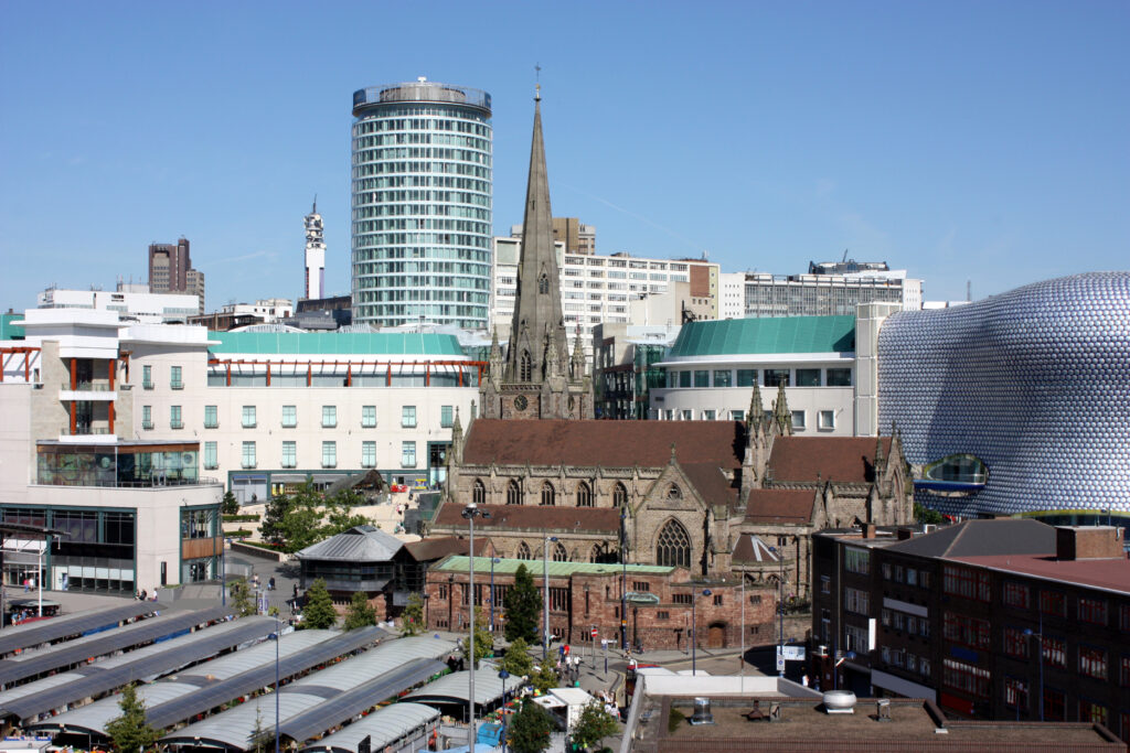
We studied the morphology of six cities worldwide using building height data at a 2 km × 2 km resolution: Auckland (New Zealand), Berlin (Germany), Birmingham (UK), London (UK), New York City (USA), and Sao Paulo (Brazil). The main parameters we used in the work were the cover of buildings at the surface, the mean building height, and the wall area.
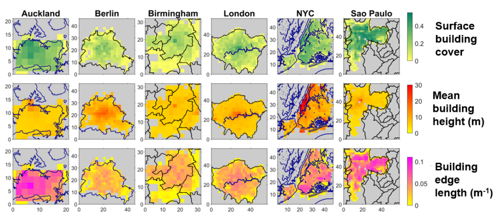
The parameterisations developed have different complexity levels, with decreasing input data requirements, allowing us to identify which level of data is required before a difference in the results. To parameterise the building cover with height, we use the mean building height and the surface building cover. The profiles of building wall area are parameterised using an ‘effective building diameter’. This assumes that the building cover and building wall area are proportional to each other, describing the width of buildings at each height if they were identical cubes or cylinders. We find that this can be roughly assumed to be 20m across all cities.
The impact of the relations for city structure that we developed had on the radiation fluxes were tested using SPARTACUS-Surface, focusing on the top of canopy albedo, and the absorbed radiation. The study revealed that we can determine the vertical structure of any urban area assuming we know three simple characteristics (surface building cover, mean building height, and an effective building diameter of 20m), with errors for albedo up to 10%. This is improved to 2% when using a better effective building diameter, calculated from the exact wall area.
This work shows that there are skilful and efficient ways to characterize cities for computationally expensive NWP models. These findings are even more useful and applicable as we move to the next generation of models that resolve the vertical structure of cities. Also, this work reflects the need for large-scale datasets to communicate the variability of cities form and materials, which are required for these parameterisation approaches. Particularly here, we show the need for datasets of building cover and mean building height.
Meg Stretton is Postdoctoral Research Assistant in the Department of Meteorology at the University of Reading.