Last week, a dust storm turned the Sydney skies orange and badly affected local air quality. Dr Claire Ryder explains why such phenomena occur and why more research is needed if we are to accurately forecast them, in a new post for The Conversation.
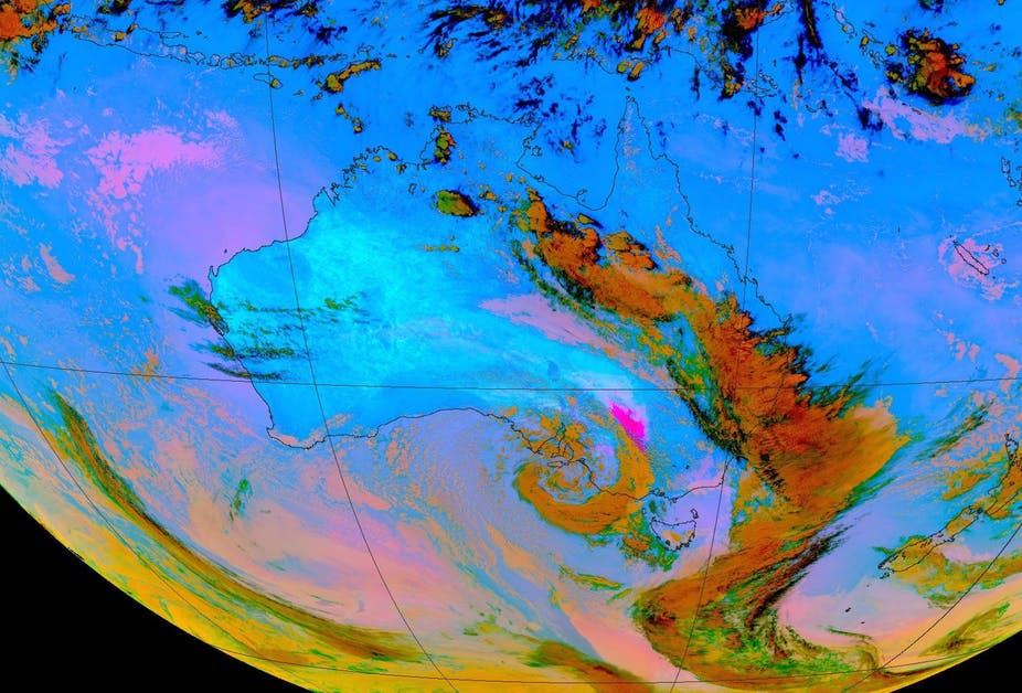
People in Sydney woke on the morning of Thursday November 22 to see a bright orange sky as the sun was blotted out by a dust storm. Visibility and air quality were very poor and people with heart and lung conditions were advised to stay indoors. Ambulance call-outs spiked and extra paramedics were called upon to deal with the crisis.
The dust cloud originated from north-western New South Wales, where strong winds ahead of a cold front met with dry, dusty soil. This lifted tiny dust particles into the atmosphere, which were carried hundreds of kilometres towards Sydney, and then onwards over the Pacific Ocean.
Any parts of the world which have an ample supply of soil dust particles, dry conditions, and strong winds are susceptible to dust storms. The “dust belt” –- a train of dust hotspots stretching from the Sahara desert across the Middle East to Central Asia, dominates global dust activity.
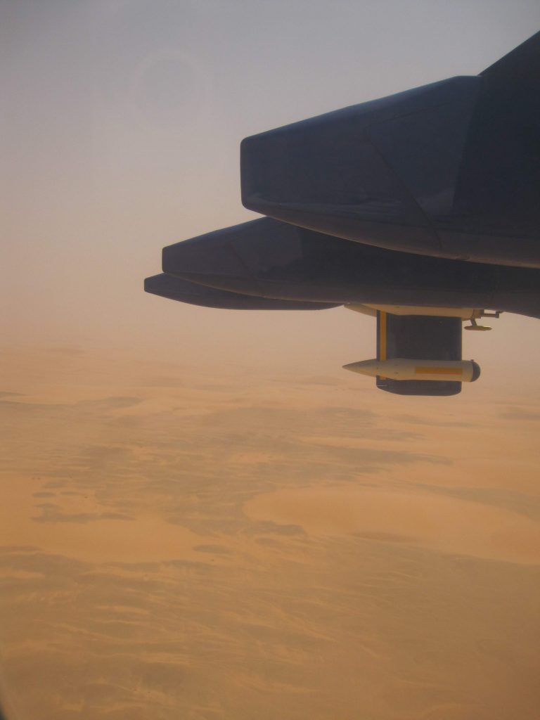
Once dust particles are lifted into the atmosphere, they are transported thousands of kilometres by the prevailing winds due to their small size –- around 1 to 10 microns – smaller than the width of a human hair. Over the Sahara during summertime, intense solar heating and convection allow dust to reach altitudes of up to 5 km, from where the dust particles can take up to ten days to sediment out of the atmosphere and travel as far as the Americas, degrading Caribbean air quality.
Although Australia has its fair share of dust hotspots, they are more abundant across the global dust belt and atmospheric dust loadings are much higher in these regions. However, many of the world’s largest dust hotspots are in sparsely inhabited regions such as the Sahara, so some of the worst impacts of dust storms are less frequently experienced by humans.
Predicting future dust storms
So what can we expect from the future in terms of dust storms? Predicting their frequency, intensity and transport requires forecasts of surface wind speeds, surface conditions such as land surface type and soil moisture, and therefore also precipitation. Accurately simulating these properties over remote, sparsely observed regions such as the Sahara even in the present day is a challenge to models due to the complex nature of the interaction between these parts of the climate system.
Climate models are a valuable tool for forecasting dust storms and how they will affect us in the future. It might be expected that, in a warmer future with more drought conditions, we would experience more dust storms. However, the environmental conditions that drive dust storms must be considered in combination.
For example, one study actually predicts a decrease in African dust emissions throughout the 21st century due to a slowdown of tropical circulation and therefore surface winds, which drive the dust uplift. This scenario would result in improved air quality in West Africa.
However elsewhere in North America, dust activity is predicted to increase by the end of the century over the Southern Great Plains largely due to reduced precipitation, enhanced land surface bareness and increased surface wind speed, while the opposite trend can be expected over the northern Great Plains.
Globally, the trend in dust activity projected across the next century by climate models is highly variable regionally and seasonally. For Australia, climate models predict more dust activity during the southern hemisphere autumn, driven by increases in surface wind speeds.
Our ability to forecast dust both in the short and long term requires an accurate understanding of the processes which drive dust uplift. Climate models need to be able to simulate surface wind speeds, precipitation, soil bareness and soil moisture, as well as the processes which drive transport in the atmosphere and allow dust particles to be carried over long distances.
Dust storms highlight how vulnerable societies are to these extreme weather events and how difficult predicting them is under a changing climate. They’re affected by soil conditions on a microscopic scale and large-scale atmospheric circulation, and so dust storms are uniquely challenging to predict and we urgently need to find out more about them if we are to adequately prepare ourselves for the future.
This post was first published on The Conversation, 23 November 2018. Dr Claire Ryder is a NERC Independent Research Fellow in Reading’s Department of Meteorology. Her research focuses on mineral dust in the atmosphere, how it can impact weather and climate, and on using aircraft observations to better understand these impacts. Over the past 12 years Dr Ryder has been involved in projects to measure airborne aerosol particles over Africa, the tropical Atlantic Ocean, south America, western Europe and around London and the UK. She uses aircraft observations to examine detailed aerosol processes and how they interact with shortwave and longwave radiation, particularly for absorbing aerosols such as dust and smoke.