Huracán is a UK–US partnership to deliver a new, physical understanding of tropical cyclone risk across the British Isles, Western Europe, and the Northeast US in a changing climate.
A four-year research programme (2023–2026) funded by the Natural Environment Research Council and the National Science Foundation.
A snapshot of North Atlantic cyclone risk:
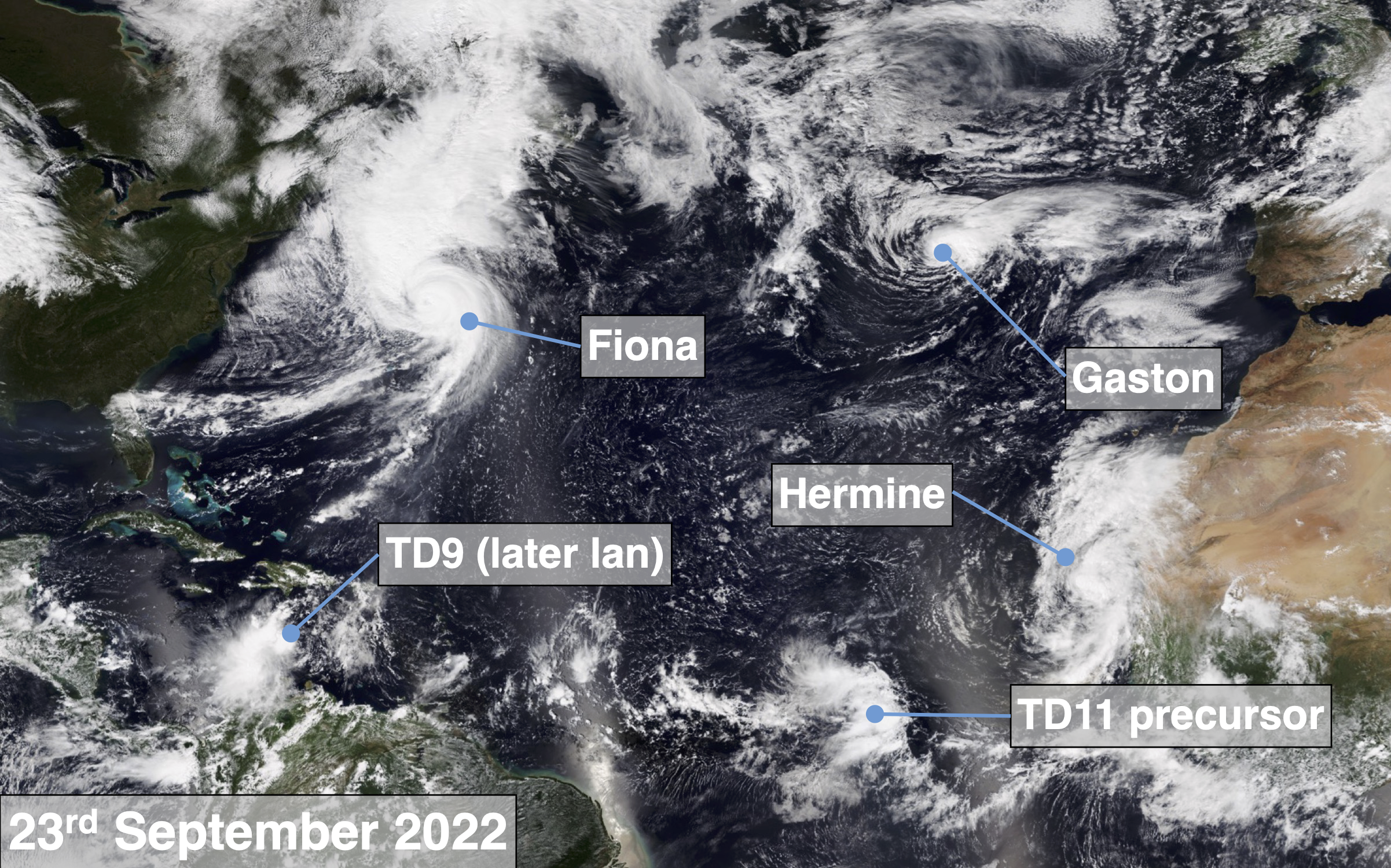
This satellite image, taken 23rd September 2022, shows multiple cyclones across the North Atlantic at various stages in their lifecycles. Two tropical depressions are seen: TD11 (in its precursor stage) off the west coast of Africa and TD9 further along in its development in the southern Caribbean. Two named tropical cyclones are present: Fiona, recurving along the US East Coast, and Hermine, seen migrating directly from the tropics towards southwestern Europe. Close to Western Europe, Gaston is transforming from a tropical storm into an extratropical storm, a process seen in approximately half of tropical systems. This image, a striking snapshot of North Atlantic weather, illustrates the broad range of cyclone processes, the varied physical storm risks, and the complex scientific problems that Huracán is tackling.