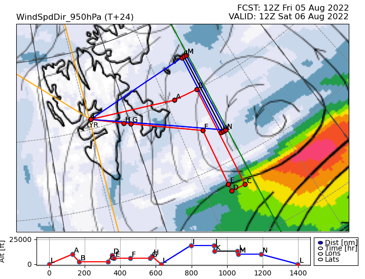
Achieved our first science flight through an Arctic cyclone just behind the centre of the low as it progressed eastwards, passing close by the south of Svalbard. The MASIN Twin Otter and SAFIRE ATR42 aircraft flew coordinated legs through the frontal rain band on the northern flank of the cyclone. The Twin Otter (red track) flew southwards at 2600 feet (B to C) right across the cyclone from the northeasterlies to the stronger westerlies (green to red shading), emerging from the cloud band in clear air over the Barents Sea. We could make out whitecaps on the sea through broken low cloud beneath the stronger winds.
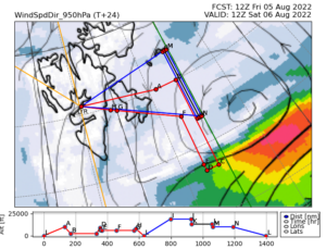
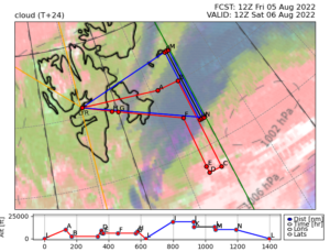
Our return leg we flew at 6000 feet (above the strongest winds, D to G). The measurements from both legs will be linked with the three legs of the ATR42 aircraft (blue track) at 19000, 13000 and 10000 feet. Combining the data, we have observations on a vertical stack of 5 levels along 029E through the frontal cloud, plus a curtain of observations from the RALI (radar-lidar) remote sensing instruments on the ATR42 which are used to retrieve cloud liquid, ice and winds. The cloud probes on both aircraft give much more detailed information on water content in the cloud, with levels (moving upwards) characterized by supercooled liquid droplets, falling snow and ice crystals including columns, hexagonal flakes and aggregates formed by collision of different crystals in the clouds. These are the first cloud physics observations through an Arctic cyclone and will help us understand how the cyclone evolves and also the formation of precipitation in the system. The second diagram shows the forecast of cloud at high (blue), mid (green) and low (pink) levels, predicted one day in advance by the Met Office global weather forecast model.
Looking forward to a stronger Arctic cyclone approaching Svalbard today from the south, with a planned coordinated flight into the cyclone tomorrow morning.