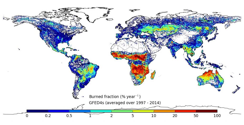
In 2017, Andela et al. (Science) indicated that there had been a global decline in burnt are over the last two decades and specifically attributed this to anthropogenic activities. Furthermore, they went on to claim that state-of-the-art climate models were unable to predict this trend because they do not incorporate appropriate treatments of human influences on fire. This paper has been a cause of great concern, partly because of concern about the methodology and partly because of the sweeping statements made about the FireMIP models.
A recent paper, led by Matthias Forkel of the Technical University of Vienna in collaboration with the SPECIAL team and members of FireMIP, provides a more nuanced analysis of recent trends. It demonstrates that the trend demonstrated by Andela et al. (2017) is strongly dependent on the choice of satellite data set and the interval examined: using a different burnt area data set or changing the length of the time period considered shows that there has been no significant global trend in burnt area because of the very high inter-annual variability in fire. There is still a strong and significant downward trend in burnt area in northern Africa, and Forkel et al. (2019) also show that some of the global models assessed by Andela et al. (2017) actually reproduce this trend. By using the SOFIA model, a generic empirical model, Forkel et al. (2019) show this trend is associated with increasing population density but is also caused by increasing wetness across the region. The interplay of anthropogenic and environmental factors causes very different fire responses in different regions.
So, it seems there is still much to do to understand changing fire regimes at a regional scale – work for the new Leverhulme Centre for Wildfires, Environment and Society, in which SPECIAL will play an active role.