TAMSAT Soil Moisture
Summary
The TAMSAT Group and the National Centre for Earth Observation (NCEO) have developed a new soil moisture product providing reliable estimates of soil moisture at rooting depth for all Africa from January 1983. Soil moisture estimates are provided at the daily scale at 0.25°x0.25° spatial resolution. The dataset has been produced using a land surface model (the UK Met Office JULES model) tuned to SMAP satellite soil moisture observations and forced with TAMSAT satellite rainfall estimates.
What does the new dataset provide?
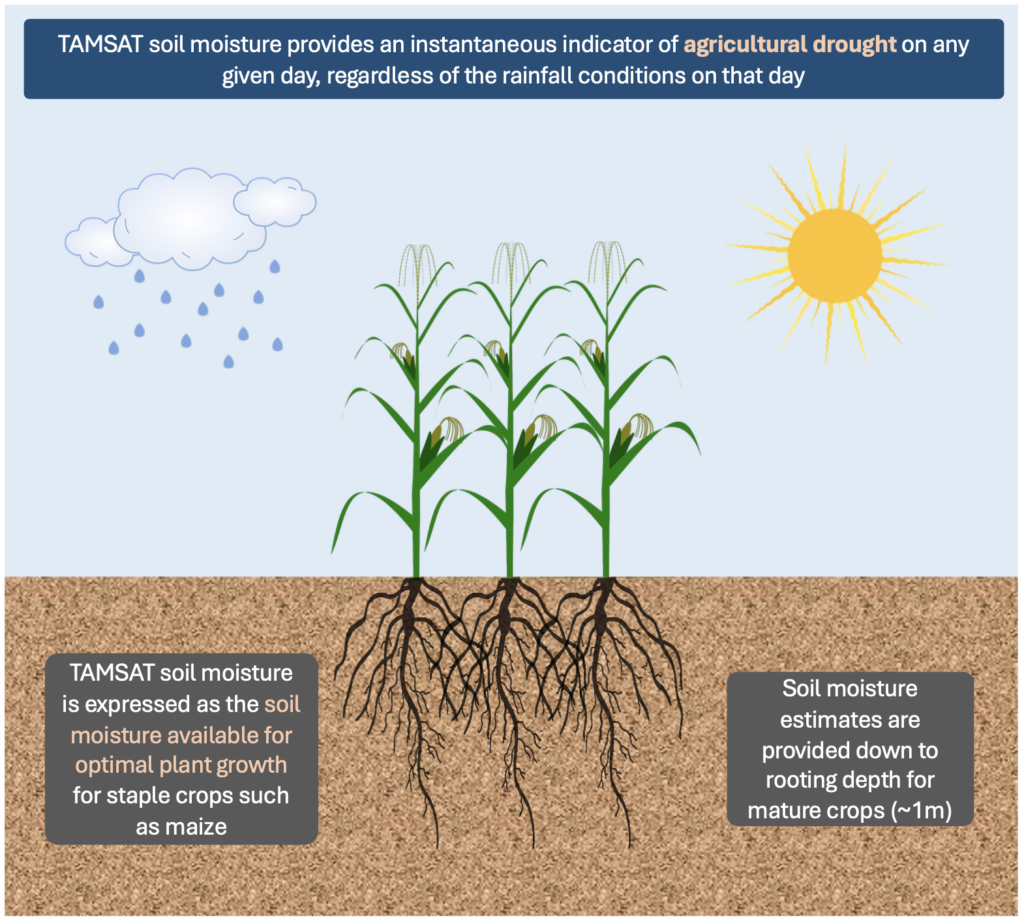
Soil moisture can be expressed in many ways. TAMSAT soil moisture data provides estimates of the soil moisture availability factor for plants or soil moisture stress factor (referred to as beta). Beta indicates how much plant growth is restricted by the available soil moisture (range 0-100; 0=plant has wilted and will not recover; 100=plant growth not constrained by soil moisture). The data are provided from 1st January 1983 to 5 months into the future, with the future data provided using the TAMSAT-ALERT forecasting system.
How are TAMSAT soil estimates generated?
Estimating soil moisture at rooting depth (~1m for mature crops such as maize) is not possible using satellite imagery alone. With the exception of in-situ measurements, which are extremely sparse across Africa, the only method to obtain information about soil moisture at rooting depth is through a land surface model that is able to estimate soil moisture conditions at various depth by taking into account meteorological conditions (e.g. rainfall, temptation, wind speed) and soil properties. TAMSAT soil moisture estimates have been generated using the JULES (the Joint UK Land Environment Simulator) model which is the land surface component in the UK Met Office’s Unified Model.
The JULES model is driven by daily TAMSAT rainfall estimates which ensures that the soil moisture has consistent mass balance with the rainfall (numerous studies have shown TAMSAT rainfall to provide skilful rainfall estimates) with other meteorological variables (e.g. temperature, windspeed) coming from the NCEP reanalysis. Lastly, SMAP satellite soil moisture observations are used to tune the soil hydraulic properties within JULES which greatly reduces error in the generated soil moisture.
Demonstration
Below is a daily animation of the soil moisture availability factor anomaly for the period 1st January 2018 – 31st December 2019. Red areas denotes regions where the soil moisture availability factor is below the long-term average and hence likely to be experiencing agricultural drought. A notable example of this is during January 2018 over central Southern Africa which experienced a damaging dry period during the growing season. In contrast, blue regions denote areas that are experiencing above-average soil moisture and are unlikely to be experiencing plant water stress (e.g. East Africa during the end of 2019).
A key strength of the TAMSAT soil moisture data is the longevity of the dataset (+40 years) which is a key requirement for assessing agricultural drought risk. The animation below highlights this strength by providing soil moisture availability factor anomaly time-series for Ghana, Kenya and Zambia from January 1983 until December 2023. Regions of the figure shaded red indicate periods likely to be experiencing agricultural drought.
Dataset usage
The new dataset is designed to assist the relevant sectors in monitoring land surface conditions and identify areas where mature crops are likely to be experiencing water stress.
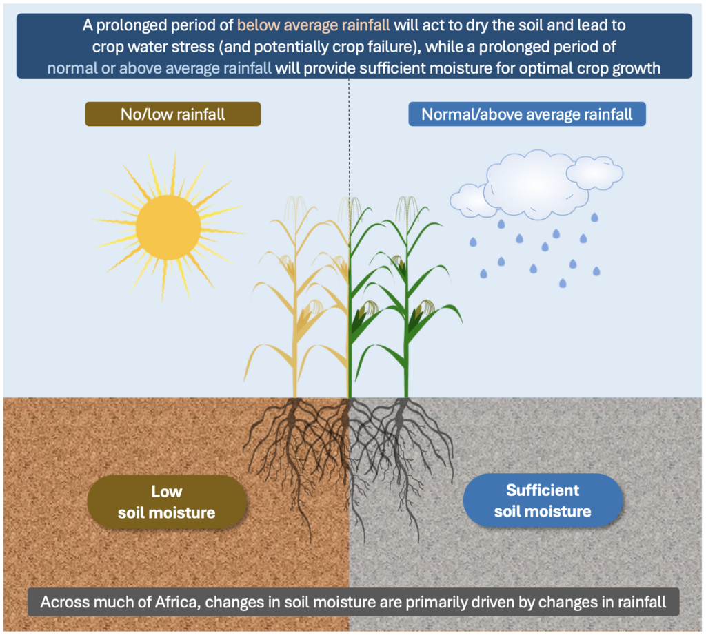
While rainfall is the primary determinant of water stress, the antecedent soil moisture and the impact of meteorological conditions other than rainfall (e.g. temperature) can also be important. The new dataset, which takes all these features into account, is therefore valuable in identifying conditions that can lead to poor crop growth or even crop failure.
Soil moisture dataset overview
| Products |
Soil moisture is expressed as the soil moisture availability factor for plants (C4 grasses) (this is labelled as ‘sm_c4grass’ in the data files and is also known as beta or fsmc for users familiar with the JULES land surface model). This variable relates how much plant growth is restricted by the available soil moisture (range: 0-100 where 0=plant has wilted and will not recover; 100=plant growth not constrained by soil moisture). This variable is what we recommend for agricultural drought monitoring for common crops such as maize and is what is served through the data ‘Time and area subsetting’ tool at the top of this page. We also produce the moisture content for different soil moisture layers (depths: 0-10cm, 10-35cm, 35-100cm, 100-300cm – this variable is also known as smcl for users familiar with the JULES land surface model) as well as other water balance variables derived from the JULES land surface model. These data are accessible from the EOCIS Data Platform and are also available upon request. |
| Latest version | v2.3.1 (released January 2025; previous version 2.3.0 released January 2024) |
| Time-step | daily, pentadal, dekadal, monthly, seasonal |
| Spatial domain | African continent, including Madagascar (N: 37.375°, S: -35.375°, W: -17.875°, E:51.375°) |
| Dimensions | 292 pixels (latitude) by 278 pixels (longitude) |
| Spatial resolution | 0.25° (approx. 25km) |
| Temporal coverage | 1st January 1983 to present day [historical record]; out to 160 days [forecasts using the TAMSAT-ALERT system] |
| Latency | within 2 days after each pentad – the products are created on the following days of each month;
|
| Data format | netCDF |
| Available variable | ‘sm_c4grass‘ |
| Cost and Terms of use | TAMSAT data are free to use and are released for operational, research and commercial use under the terms of the Creative Commons Attribution 4.0 International license (CC BY 4.0). To view a copy of this license, visit https://creativecommons.org/licenses/by/4.0/. |
| Citation | Please cite the following papers if using TAMSAT soil moisture estimates:
|