Lead supervisor: Deepa Senapathi, School of Agriculture, Policy and Development, University of Reading
Email: g.d.senapathi@reading.ac.uk
Co-supervisors: France Gerard, UK Centre for Ecology and Hydrology; Simon Potts, School of Agriculture, Policy and Development, University of Reading
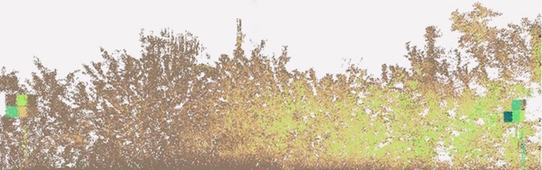
Figure caption: Terrestrial LIDAR image of a hedgerow © France Gerard, UKCEH
Sustainable land management of arable farmland is a critical component of ensuring food security and ensuring progress towards sustainable development goals including life on land, zero hunger responsible consumption and production. Understanding the impacts that land management has on farmland biodiversity and associated ecosystem service provision is therefore a key priority area for research, policy and practice. The move towards nature positive farming and targets towards biodiversity net gain and achieving net zero are increasingly depending on novel methods to enable us to monitor, quantify and asses impact of land management on both habitats and species.
The use of emerging technology in agri-environmental systems is gaining momentum and there’s a need to train up the next generation of researchers in fast advancing technological expertise whilst providing them a firm foundation in the practical applications of such technology. This project will combine expertise in drone LIDAR technology to help map key habitats (i.e hedgerows) within the farming landscape, quantify how different agricultural management impact the quality and configuration of hedgerows and assess the impact of hedgerow quality on the abundance and diversity of key farmland pollinators. Drone LIDAR will be used for High-Resolution 3D Mapping of the landscape by capturing fine details to assess the height, width, and overall structure of hedgerows. LIDAR data enables assessment of hedgerow density and health by distinguishing different vegetation types and can reveal areas of low or high vegetation density which is crucial for understanding hedgerow quality. In addition, Drone LIDAR can help determine how effectively hedgerows connect different parts of the landscape, and identify gaps or disruptions in the hedgerow network, which are known to impact the abundance and diversity of farmland biodiversity including pollinators and other beneficial insects.
Hedgerow quality will be assessed in sites with differing agricultural management regimes – these include a rewilding site, a regenerative agriculture farm and a conventional intensively farmed landscape. The hedgerow and landscape quality metrics will then be linked to on site assessment of farmland pollinator communities which are key to delivery of critical crop pollination services. We will focus on both diurnal and nocturnal insects (i.e. bees and moths) and use conventional field methods as well as emerging technology such as image recognition to characterise these insect communities such as AMI-traps attracting and imaging moths at night.
This project provides the unique opportunity to combine conventional agro ecology with emerging technology. This project will offer training in remote sensing and image recognition analyses for the student as well as upskilling them in aspects of ecology and land management to benefit biodiversity and sustainable agriculture. In particular, the student will have access to and be trained by a dedicated drone pilot from UKCEH and also receive training in remote sensing and mapping of drone LIDAR data. They will receive training in image recognition software and training in utilising AI to identify and quantify specific data on moths. They will also receive training in ecological data collection and quantitative modelling to enable them to assess the impact of different land management on farmland biodiversity.
This will then be combined with onsite land management practice through the CASE partners. The student will have opportunities to demonstrate excellence in research through high impact publications as well as contribute to practice notes or policy briefs based on evidence generated through this project.
In addition to the research undertaken in this project also has synergies and links with “MAMBO: Modern Approaches to Monitoring of BiOdiversity” – https://mambo-project.eu/ a Horizon Europe project monitoring species and habitats across Europe, that the supervisory team are involved with. This provides the student with a network of experienced and early career researchers across multiple European countries and research organisations that they can benefit from interactions with during the course of their studentship.
Training Opportunities
The student will have the opportunity to be trained and certified as a drone pilot. In addition the student will also have CASE placements at the Leckford Estate – a regenerative agriculture site to have hands one experience in land management for nature positive farming.
Student Profile
This project would be suitable for a high calibre student with a primary degree in environmental sciences, ecology, geography or similar. A master’s degree and experience of undertaking a research project with ecological field work or remote sensing / ground truthing experience would be desirable.
Funding Particulars
This project has CASE support from John Spedan Lewis Trust for Natural Sciences, Leckford Estate, Waitrose Partnership