- The development of an advance reverse engineering method to recover the original MVIRI/VIS band spectral response and to monitor its temporal degradation.
- The creation of an accurate calibration reference and associated uncertainties relying on state-of-the-art simulated top-of-atmosphere spectral radiances over CEOS Pseudo Invariant Calibration Sites including sea surfaces, bright deserts and deep convective clouds used as radiometric reference for MVIRI/VIS vicarious calibration.
- The use of a rigorous uncertainty propagation scheme based on revisited measurement equations.
- The development of an improved retrieval algorithm to derive simultaneously surface reflectance and aerosol properties in the MVIRI/VIS band.

Deriving an aerosol climate data record from Meteosat First Generation observations
by Yves Govaerts
Aerosols play an important role in Earth radiative budget through direct and indirect effects. The former effect is the mechanism by which aerosols scatter and absorb shortwave and longwave radiation, thereby altering the radiative balance of the Earth-atmosphere system. The latter effect is the mechanism by which aerosols modify the microphysical and hence the radiative properties, amount and lifetime of clouds. It is therefore essential to monitor these processes over several decades to document their temporal and spatial evolution. Since more than a decade or so, observations acquired by state-of-art radiometers are available allowing the generation of such data sets. This possibility did not exist 30 years ago when space-based observations were essentially limited to data acquired by operational geostationary satellites and AVHRR.
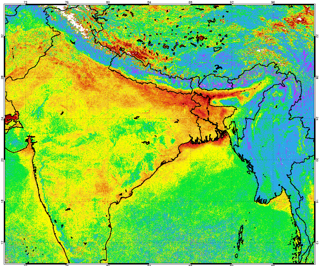
The displayed figure shows the January 2001 monthly mean aerosol optical thickness over India derived from Meteosat First Generation (MFG) radiometer observations in the so-called VIS band. This result is obtained from a joint surface reflectance – aerosol property retrieval originally initiated as a feasibility activity aiming at demonstrating the possibility to derive Climate Data Record (CDR) from operational geostationary satellites [1]. Though these first results are pretty encouraging, their quantitative interpretation remains difficult mainly due to the presence of inconsistencies in the Fundamental Climate Data Record (FCDR) used for the generation of this CDR.
Previous attempts to calibrate the VIS band of MVIRI, the radiometer on-board MFG, have revealed issues in the pre-launch characterization of the sensor spectral response and its spectral degradation [2,3] resulting into inconsistent surface albedo CDR [4]. Deriving a consistent surface albedo or aerosol CDR from MFG/MVIRI observations is thus a pretty challenging task, as this operational meteorological mission has not been originally designed to fulfil such objective. Additionally, performing quantitative retrieval in such a large spectral band running approximately from 0.4 μm up to 1.1μm pushes the limits of the monochromatic assumption when inverting a radiative transfer model.
The objective of the FIDUCEO project is to address these issues generating consistent FCDR and albedo/aerosol CDR from MVIRI/VIS observations applying rigorous (re)processing principles explicitly developed in the framework of this project. Specifically, a series of innovative tasks are undertaken to address these issues including:
