DARE pilot project with participants: Professor Lee Chapman, University of Birmingham; Sytse Koopmans; Gert-Jan Steeneveld, Wageningen University & Research (WUR)
The research will be a verification by ground truth observations of the Birmingham Urban Climate Lab (BUCL) observational network.
The worktask aims are:
- Setting up basic model run with WRF with meteorological boundaries from ECMWF
- Remapping land use from CORINE land cover inventory (100 m) to USGS classification used by WRF
- Calculate land use fraction by Landsat 8 satellite
- Derived urban morphology indicators with the NUDAPT tool
For the project we completed the model infrastructure without data assimilation and a basic run without was conducted accordingly. The main effort done in the last year was to create a geographical dataset that satisfy the 200 meter resolution. Before applying data assimilation it is important to describe the land use and urban characteristics as well as possible.
- The default available land use datasets were too course for a 200m run. We have remapped the 100m Corine land use dataset to a format which can be read by WRF.
- The urban morphology has been improved by applying the National Urban Database and Access Portal Tool (NUDAPT) (Ching et al, 2009*). With this step we progressed the representation of urban morphology in the WRF model compared to previous studies.
NUDAPT has been tested against more elementary and basic representations in WRF in a study for a Chinese city. The performance of NUDAPT looks promising.
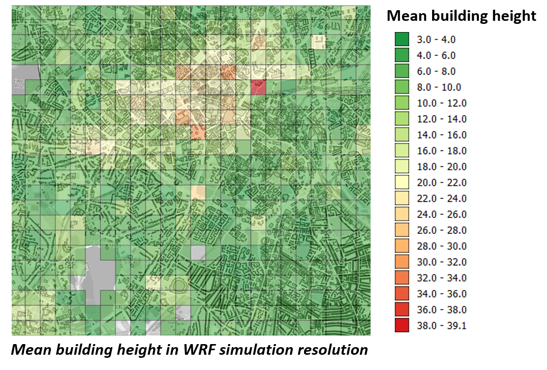
Image 1 – Mean building height Birmingham
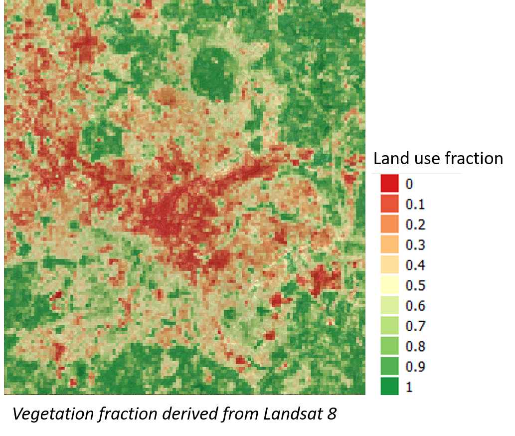
Image 2: Land use fraction Birmingham
*Ching J, Brown M, McPherson T, Burian S, Chen F, Cionco R, Hanna A, Hultgren T, Sailor D, Taha H, Williams D. 2009. National Urban Database and Access Portal Tool, NUDAPT. Bulletin of the American Meteorological Society 90( 8): 1157– 1168.