Get Ready to Dig
Preparation for digging at Silchester takes many months with planning for each new season beginning as soon as the last one ends. There are many things to consider each year including where we will be digging, what we want to achieve and how do we get the best results with the resources that we have
Before we start
Here are a few of the tools that we can use to help us identify how to best achieve our research aims
As we approach the start of each season there are many logistical challenges to be met: from what facilities we need to order to how to make things safe and which tools we will need for the job
On site
Test Pits
If you are starting a new site, digging test pits is a great way to establish the depth of the archaeology and identify any problems that you might encounter: in particular whether you are digging in the right place before you commit to machining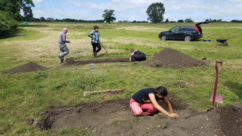
De-Backfilling
Each season if we will be continuing in the same trench the next year we cover the area with plastic and ‘backfill’ on top to protect the archaeology for the forthcoming winter. Removing this covering and cleaning the trench in preparation for a new season is often hard and mucky work. Here our second and third year students show how they’re up to the challenge
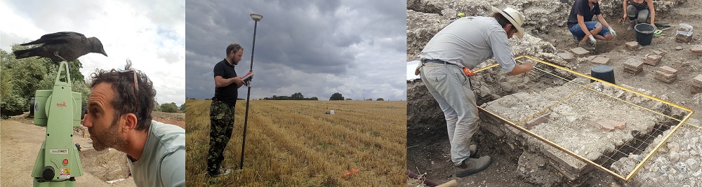
Surveying
Having a site grid allows everything in the trench to be recorded in the right place. By using a combination of a GPS, total station theodolite and good-old tapes and strings, we can install a 5m by 5m framework across the site which can then be used to draw plans of the archaeology and locate finds to the nearest millimetre.
Digging Safely
This video shows the logistical difficulties of digging a deep feature, in this instance the Iron Age ditch at the bathhouse. Stepping each side of the section for safety requires significant forward planning and the groundwater rising from the base of the ditch needs to be pumped away every 15 minutes or so. A great feat of engineering all round
Find out more…
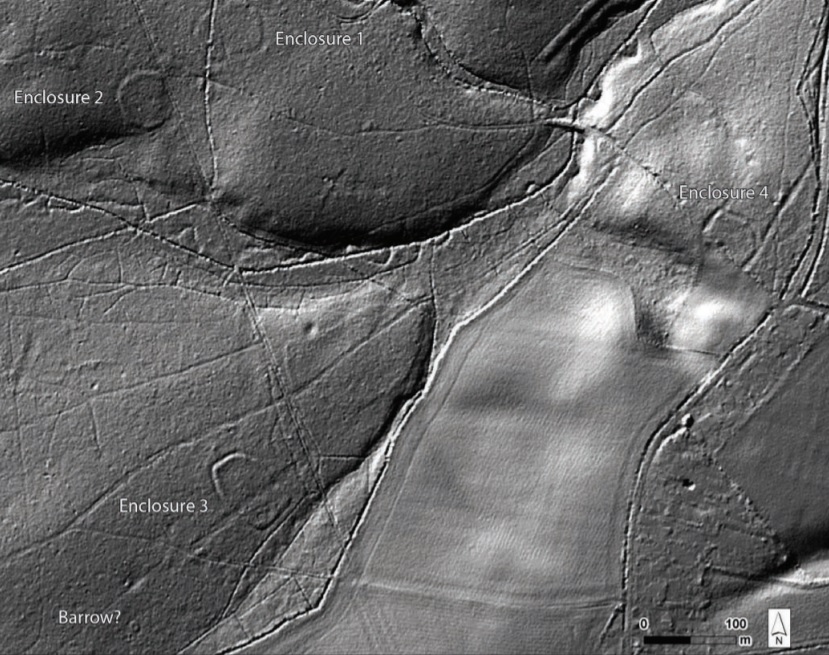
Remote Sensing
When researching areas prior to excavation there are a number of methods of ‘remote sensing’ that can identify archaeological sites that may not be seen from the ground. Using aerial photographs to interpret archaeology has been popularised ever since the mass used of aerial surveillance in World War II but a new form of laser scanning has heralded huge advances in finding hidden sites. LiDAR is a plane-mounted scanning technique that can penetrate through forest canopies and heavy vegetation and differentiate minute differences in topography
Silchester Environs team member Krystyna Truscoe compiled a detailed examination of all aerial photographs and LiDAR within a 140km² study area around Calleva. Although with an emphasis on the Iron Age to Roman transition, she aimed to characterise the changing history of the landscape as a whole and show what effects archaeological monuments had on the area from the Neolithic to the Cold War. Her report can now be downloaded from the Historic England website here and provides a fantastic reference for numerous hitherto-unstudied local sites, as well as the wider archaeological landscape.
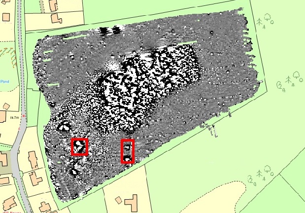
Find out how LiDAR helped us identify a series of never-before-seen monuments within nearby Pamber Forest, and what we found when we excavated them (PDF)
This geophysics plot led us to discover the earliest kilns associated with Silchester and became another piece in the mysterious puzzle of Nero and his influence at Calleva. Find out more here
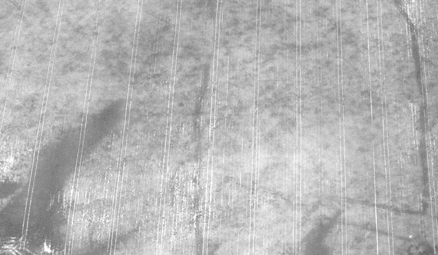 The dark dot at the centre of this aerial photo from Windabout Copse turned out to be one of our most exciting discoveries ever. Find out what it was here